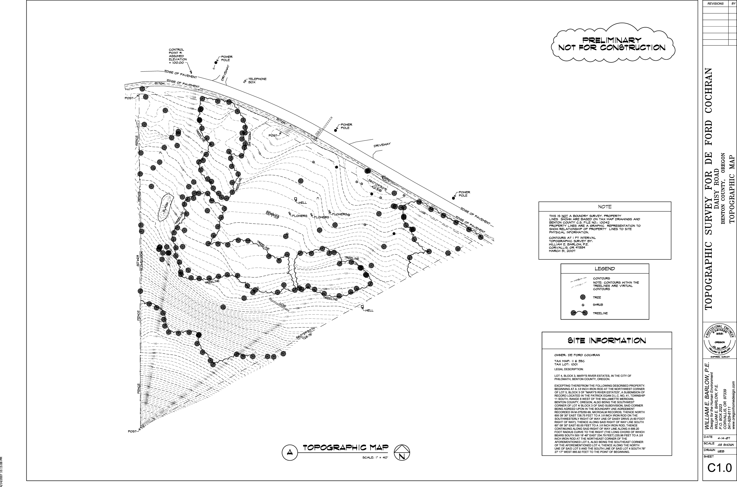
- Topographic Surveying*
- Topographic Surveying Philosophy
- When I operate a Total Station and data collector to record information about a site being surveyed, I visualize how the data collected about the physical features of the site will be represented in AutoCAD to produce high quality contours for the design of the site. (Contours are two-dimensional lines representing lines labeled with an elevation representing three-dimensional space.)
- Topographic Surveying Services*
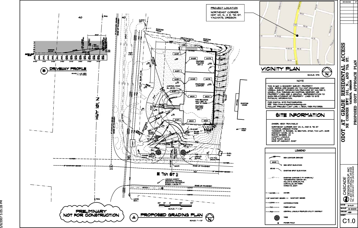
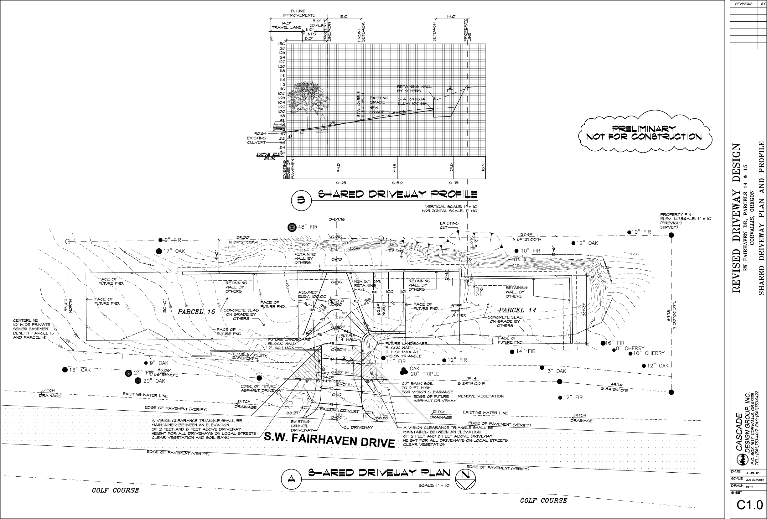
- Residential Sites and Site Planning
- Commercial Land and Site Planning
- Land for Sudivision Design and Planning